East Gate in Context
All Roads Lead To The River
After the Revolutionary War, population in New York City grew at a rapid pace and demanded produce, flour, grains and livestock. This meant a steady source of income for farmers in what today are Columbia County, NY, and Berkshire County, MA. But getting goods from the farm to New York meant carting them west to the Hudson River, where they would be sent down to the City by ship.
The trip was not an easy one. The road to Hudson was scarcely more than a rutted path, snowy in the winter and muddy in the spring. Often between the ruts were tree stumps left behind when the original path was cleared. Sometimes a wagon would sink into the mud as it was passing over a stump and get stuck, leaving the driver to ponder what to do next, because he was “stumped.”
There had to be a better way…
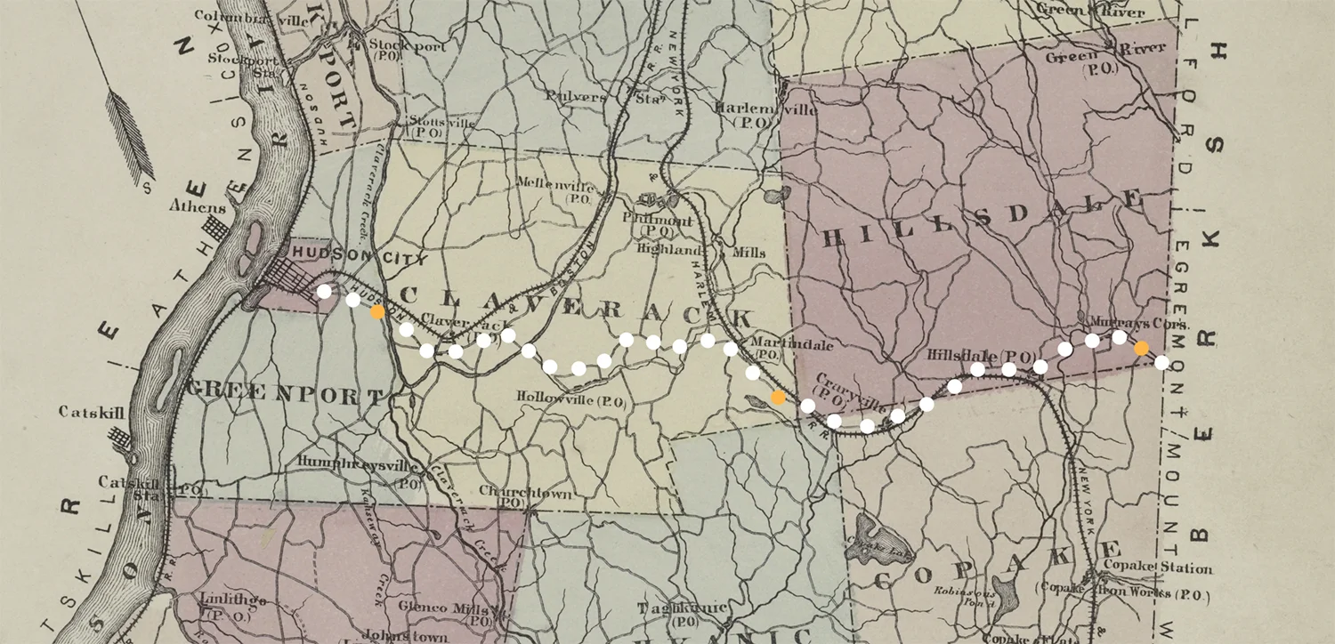
Columbia Turnpike Route
Lionel Pincus and Princess Firyal Map Division, The New York Public Library. "Columbia Co." The New York Public Library Digital Collections. 1873.
The Columbia Turnpike
In 1799, the New York State legislature authorized the creation of the the Columbia Turnpike Corporation "for improving the road, from the city of Hudson, to the line of Massachusetts, on the route to Hartford." The Columbia Turnpike was constructed, which more or less followed today’s routes 23 and 23B. It was the first turnpike in Columbia County and the fifth in New York State. The legislature also gave the right of the Corporation to use existing roads and approved the construction of three toll houses, spaced about ten miles apart. The revenues from the tolls paid by travelers covered the cost of construction and ongoing maintenance of the turnpike.
The Corporation attracted 13 “incorporators” or main investors. Capital stock was set at $25,000. The charter provided that incorporators were to pay $25 per share of stock and subscribers, $10. After the sale of 400 shares, with the total limited to $1,000 shares, election of officers was to take place.
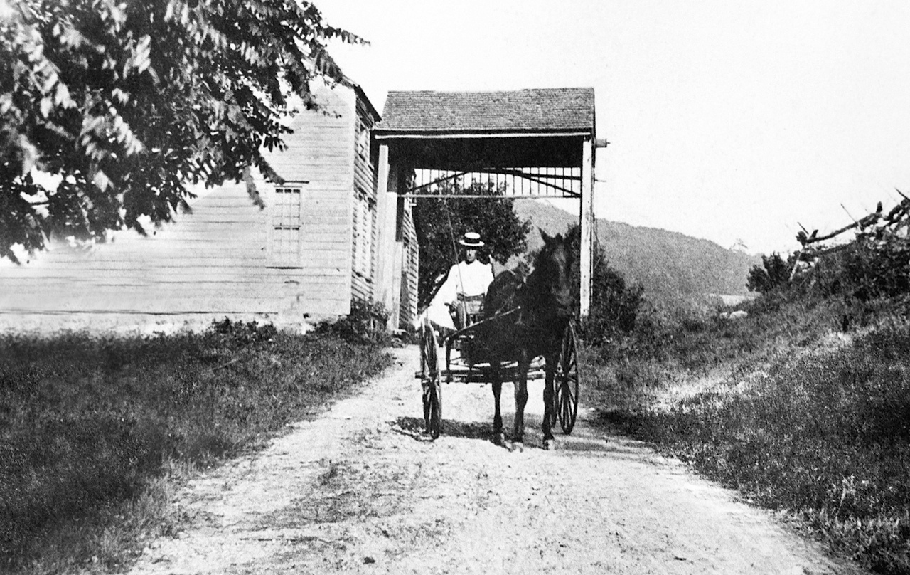
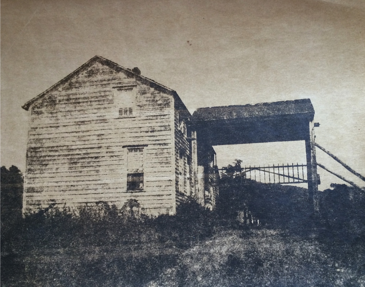
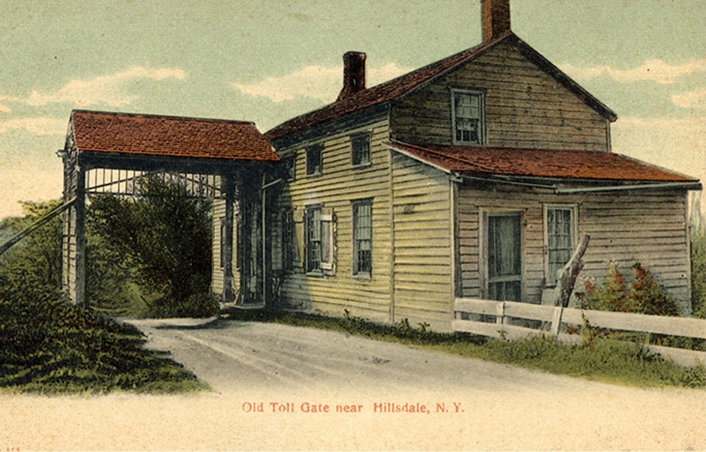
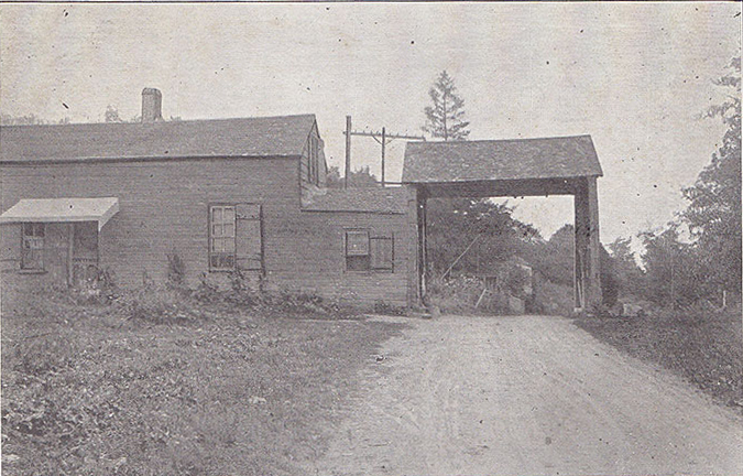
Historic East Gate Toll House
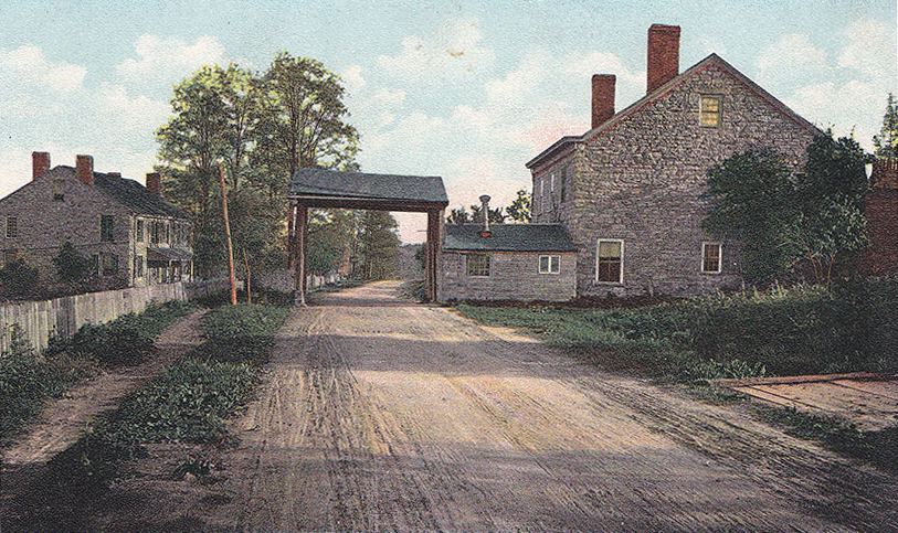
The Toll Houses
The three toll houses were known as the East Gate, in Hillsdale; the Middle Gate, in Martindale; and the West Gate, in Greenport. The turnpike operated until 1907. The East Gate Toll House was a private residence for generations until it was acquired in 1970 by Eldena Jenssen, who intended to preserve the venerable old building. Thanks to a generous donation from Copake Falls resident Edgar Masters, Friends of East Gate purchased the toll house from the Jenssen family in late 2016.
The East Gate Toll House was listed in the National Register of Historic Places in June 2016.